
Garmin eTrex® Solar, GPS Handheld Navigator, Unlimited Battery Life, Water Resistant
The 2.2” high-contrast display is easy to read, even in bright sunlight. Get unlimit…
★★★★☆ 4.1
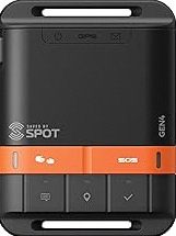
Bundle Includes: Garmin inReach Mini 3 Compact SOS Satellite Communicator+ Microfiber Cleaning Cloth + P-Bank Battery + Generic Brand 10ft USB Type A to USB Type C cable - Black + USB Wall Charger + Universal 2-port USB Car adapter. GLOBAL SATELLITE COMMUNICATION: Stay in touch beyond cell service using the global Iridium satellite network. Send and receive text messages, share your GPS location, and communicate in remote areas where coverage doesn’t exist. Designed for explorers, backpackers, and off-grid professionals who need reliable two-way connectivity anywhere adventure takes them.. INTERACTIVE SOS AND EMERGENCY RESPONSE: Trigger an interactive SOS alert to Garmin Response, a 24/7-staffed international emergency coordination center. Your location and message are transmitted instantly to initiate a rescue or support operation. Ideal for hikers, backcountry travelers, and remote workers who prioritize safety and peace of mind when far from help.. RUGGED DESIGN AND LONG BATTERY LIFE: Built to withstand harsh environments, the inReach Mini 3 features a durable, IP67-rated body and a scratch-resistant color touchscreen display. The internal rechargeable battery delivers up to 350 hours of operation with 10-minute tracking, keeping you powered for extended trips or emergencies in extreme conditions.. SMART CONNECTIVITY AND LOCATION SHARING: Pair with the Garmin Messenger or Garmin Explore app for effortless trip planning, navigation, and LiveTrack location sharing. Send preset check-ins or custom messages, request weather updates, and let friends follow your progress in real time. Compatible with Garmin smartwatches and handhelds for seamless control and monitoring.
This page focuses on the details buyers usually scan first: price position, review signal, and whether fits the current shortlist.
Garmin inReach Mini 3 Satellite Communicator, Lightweight Compact Rugged Design, Portable GPS Handheld for Hiking, Two-Way Text Messaging Device Bundle with Accessories stays popular because verified authentic • top rated, making it easier to compare against similar items from PrisShop.
You can use this overview to compare value, positioning, and feedback before moving to the next product.
Recent buyer notes here make it easier to scan confidence, delivery, and fit signals before moving to another listing.
These comments add quick context around expectations, repeat purchase intent, and the type of use buyers describe most often.