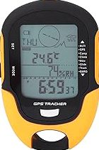

Garmin eTrex® Solar, GPS Handheld Navigator, Unlimited Battery Life, Water Resistant
The 2.2” high-contrast display is easy to read, even in bright sunlight. Get unlimit…
★★★★☆ 4.1
Explore confidently with the reliable handheld GPS. 2.2” sunlight-readable color display with 240 x 320 display pixels for improved readability. Preloaded with Topo Active maps with routable roads and trails for cycling and hiking. Support for GPS and GLONASS satellite systems allows for tracking in more challenging environments than GPS alone. 8 GB of internal memory for map downloads plus a micro SD card slot
This page focuses on the details buyers usually scan first: price position, review signal, and whether fits the current shortlist.
Garmin eTrex 32x, Rugged Handheld GPS Navigator stays popular because verified authentic • top rated, making it easier to compare against similar items from PrisShop.
You can use this overview to compare value, positioning, and feedback before moving to the next product.
Recent buyer notes here make it easier to scan confidence, delivery, and fit signals before moving to another listing.
These comments add quick context around expectations, repeat purchase intent, and the type of use buyers describe most often.